Day 3: Alta Meadows to Wolverton Cutoff Ridge (November 24, 2012)
The snow had adjusted under my weight during the night leaving me with an uncomfortable position for my back and causing me to get up with the sun. The air was cold as the sun slowly climbed out from behind the ridge, its warmth only reaching us after breakfast.
We took our time with breakfast and breaking down camp since we didn’t have far to hike. We were heading towards Wolverton Cutoff, which would take us over the ridge towards the Giant Sequoias and back to the car.
Descending towards the High Sierra Trail
The sun had warmed the air significantly by the time we started down the trail at about 10 AM. We backtracked 2.2 miles towards the Merhtan Creek trail split, then descended another 2.2 miles to the High Sierra Trail.
 We quickly dropped below snow line and the trail became wet with snow melt. The High Sierra trail brought us to a rocky clearing where it crossed Merhtan Creek. The warm rocks were a nice spot to have lunch and let the boots and socks dry in the sun. There are also some camping spots tucked away in the trees above the trail complete with fire rings and bear boxes.
After lunch we took on a full load of water since we would be camping on a ridge with no streams this night.
 Continuing down the trail, and down in elevation, we wound our way through wooded hillside for about 3 miles before climbing again on the Wolverton Cutoff trail. We climbed a short ways to the top of the ridge where we made camp for the night. Some day hikers were taking in a view of the valley from a rock out cropping nearby.
The view from the out cropping was perfect for watching the sun set. From there were could see down into the valley in one direction, and up to the summit of Alta Peak in the other. We could even pick out our trail in the snow leading up to the summit! Looking at our tracks made me wonder if anyone had been sitting in this spot the day before watching us trudge our way to the top…
View from camp on Wolverton Cutoff Trail (Alta Peak at left)
As the sun light faded, we made a small camp fire for about an hour after dinner. The temperature was a little below 50°F and didn’t drop too much after dark, and sitting by a fire was a nice change from going strait to bed after dinner.
Day 4: The Giant Forest (November 25, 2012)
The night was pleasant with the temperature never getting close to freezing, and the morning was comfortable for breakfast. After breaking camp and hitting the trail, we quickly dropped into the Giant Forest.
My pace slowed as I stubbled over sticks every few steps, my eyes gazing upwards focused on the trees towering above. Looking around at eye level, you could almost forget these were trees and not giant columns holding up the sky.
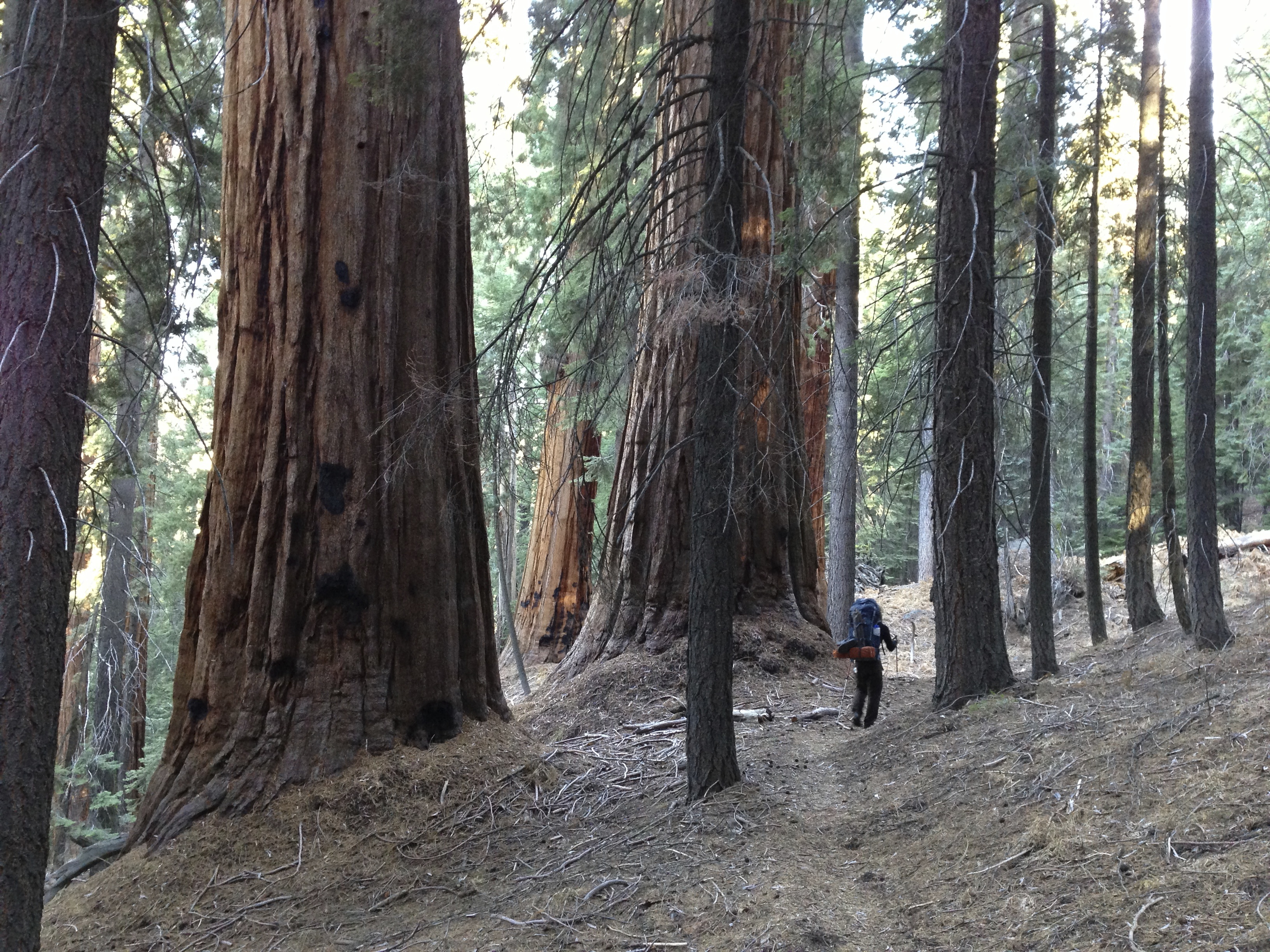
It was only a few miles back to the car. We arrived before lunch, then made the short drive down the road to go visit the biggest of the giants, General Sherman.
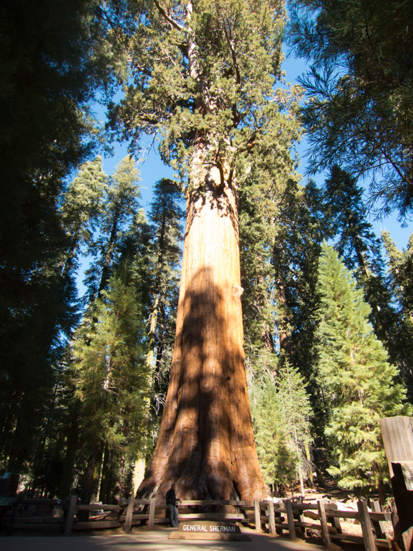
General Sherman, World’s Largest Tree (Can you see me at the bottom?)
Be sure to check out Days 1 & 2 of this trip HERE
For more photos from this trip visit the album on Flickr